Waterway Engineering
Flood early warning systems

Waterway Engineering helps communities build Flood Early Warning Systems that turn real-time information into timely, actionable warnings. Our team combines flood-risk analysis, engineering, emergency management planning, public warning strategies, and outdoor warning siren design to develop systems tailored to each community’s hazards and operational needs. From initial assessment and system planning through funding, installation, activation protocols, training, and long-term improvement, we work alongside local officials to ensure warning systems are not only technically sound, but ready to perform during real flood emergencies. Waterway is currently supporting counties across Texas in strengthening flood preparedness and meeting the requirements of Senate Bill 3.
our projects
Texas Senate Bill 3 County Flood Early Warning Systems
Texas Senate Bill 3 put state funding behind county flood warning for the first time. Waterway is the prime engineer for twenty of those counties — among them Kerr, Real, Uvalde, Edwards, Kimble and Mason — which makes this one of the largest coordinated flood warning efforts in the state.
Each county follows the same path. Waterway inventories what already exists, refines the county's flood-prone area mapping for state review, and designs the system: siren locations verified with sound-coverage modeling, stream gage placement, and civil and structural design for every site. Running alongside the engineering is a preparedness track — a county flood preparedness assessment, a public communications plan, an emergency action plan and an operations and maintenance manual — because a siren nobody has planned around is just noise.

H.E. Butt Foundation Camp Flood Early Warning System
Following the catastrophic July 2025 flooding in the Texas Hill Country, the H.E. Butt Foundation retained Waterway Engineering to design, install, and operationalize a Flood Early Warning System for its camp properties along the East Frio River in Real County, Texas.
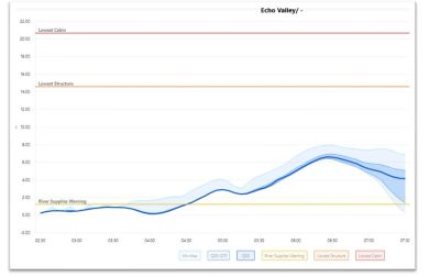
As prime consultant and project manager, Waterway led a multi-disciplinary team to deliver an integrated system built on four components: a network of eight satellite-telemetered stream and rain gages reporting on a five-minute interval; a real-time HEC-HMS hydrologic model of the 47-square-mile upper watershed running automatically in the cloud; a radar-based short-term rainfall forecasting method (STEPS) selected for its low latency in fast-developing convective storms; and a hydrogeologic evaluation of the watershed's karst terrain that informs how much rainfall infiltrates versus runs off. Waterway also completed a camp-wide flood risk and impact assessment identifying which roads, low-water crossings, and structures are affected at each flood level.
In a watershed where critical flood stages can be reached in under 30 minutes of peak rainfall, the system gives camp staff meaningful lead time to protect guests, staff, and property.